About the Initiative
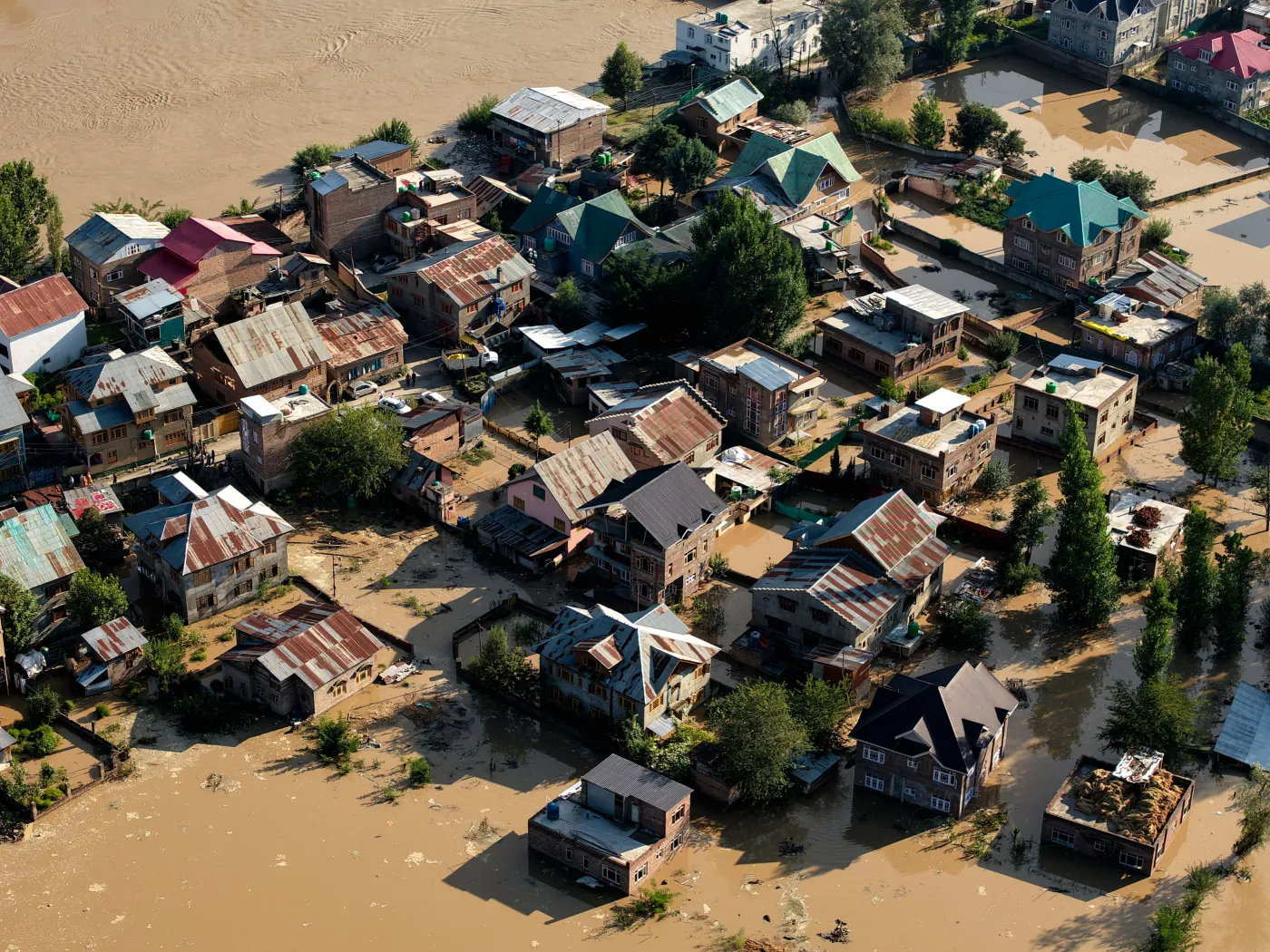
Project SummaryThe intensification of climate-related natural disasters is driving rapid demand for satellite-based early warning and disaster risk reduction. Climate-vulnerable nations — in particular Small Island Developing States (SIDS) and Least Developed Countries (LDCs), many of which are Commonwealth members across the Pacific, Caribbean and Africa — face structural vulnerabilities arising from fragile ground infrastructure and limited access to space-based data.
The Space4Resilience Initiative positions satellite data as a shared global public infrastructure, enabling vulnerable countries — including across the Commonwealth's 56 Member States — to respond to climate crises and disasters. The Initiative will move from its official launch at the 69th session of the Committee on the Peaceful Uses of Outer Space (COPUOS) in June 2026 towards full institutionalisation, defining its governance, methodology, financing and private-sector coordination.
A Three-Pillar Partnership
UN-recognised · Commonwealth-network · Technology-deployedThe Initiative closes the response gap by combining three complementary strengths, leveraging the distinct mandate of each partner.
International legitimacy and neutral convening authority, reinforcing UN-SPIDER's mandate on space-based information for disaster management.
A trusted deployment channel reaching all 56 Commonwealth Member States — frictionless deployment to those that need it most.
Cutting-edge satellite-data technologies, services and implementation capacity — plus initial funding to implement at pace.
Context & Need
Demand for space-based disaster solutions is rising rapidly as climate hazards grow in frequency and severity, yet a persistent gap remains between international climate commitments and the capacity to respond on the ground. Countries with the highest exposure to climate disasters frequently lack access to satellite data and the means to use it.
The Initiative is technology-agnostic, drawing on the full range of space technologies in line with the recognition by UN-SPIDER and UN General Assembly resolution 61/110 of their role across the disaster cycle — Earth observation (optical, radar/SAR and hyperspectral imagery), communication satellites for alerts and connectivity, and positioning & navigation (GNSS) for ground-deformation monitoring and field operations.
Four-Function Service Model
From data access to policy implementation
S4R Data Hub
Unified access to proprietary satellite-analytics datasets alongside open institutional data.
Intelligence Layer
Turns raw data into decision-ready dashboards, including AI-driven 3D digital twins.
Capacity Building
Annual cohorts of 20–30 officials in 3–6 month programmes, in Japan and via regional anchors.
Project Formation
Tailored "National Resilience Packages" and support for concrete national projects.
Governance
A lean, expert-led structureThe Initiative is steered by a Steering Committee of approximately five experts providing strategic direction and quality assurance, supported by an Operations Office acting as secretariat. By design the Committee is international in composition, with only one member from the technology partner.
- UNOOSA — Chair (Director level): UN legitimacy, neutrality and alignment with the Space2030 Agenda and SDGs.
- SpaceData (Japan) — Technology lead for the satellite-data platform; sole national-of-Japan seat.
- Academic expert — Independent authority on Earth observation and disaster science.
- Evaluation & certification expert — Responsible for the Evaluation Index and independent pilot assessment.
- Regional representation expert — A regional voice for beneficiary States (Pacific, Caribbean, Africa).
Day-to-day coordination — needs collection, meeting organisation, and progress and schedule management — is led by SpaceData on behalf of the partnership, under the strategic direction of the Steering Committee and the substantive guidance of UNOOSA / UN-SPIDER.
Board & Office Members
The people behind the InitiativeBoard Members — Steering Committee


Office Members — Operations Office


Methodology
A defined six-step approachA repeatable methodology turns Member State needs into evaluated, scalable pilots. Outcomes are defined explicitly up front, and all partners agree them at the close of each cycle.
Collect Issues
Needs from 56 Member StatesAnalyze & Sort
Trends & categories → needs mapEvaluation Index
Prioritize objectivelySelect Partner
Region · issue · solutionRun Pilot
Field test with institutionsEvaluate
Assess via the IndexPhased Roadmap & Milestones
Launch at COPUOS
Official launch of the Space4Resilience Initiative at the 69th session of COPUOS.
Present summaries & Evaluation Index
Phase 1 — collect issues, produce summaries, and develop the Evaluation Index.
Present solutions & start pilot
Phase 2 — pilot design and build team; announce solutions and pilot selection.
Present outcome of pilot project
Evaluate the pilot against the Index to prepare for scale-up.
Expand across the Commonwealth family
Workshops across the Caribbean, Pacific, Latin America and Africa accompany M1–M3.
Overall Outcomes
All resulting in strengthened resilience of Commonwealth Member States through space-based solutions, in support of the Space2030 Agenda and the SDGs:

Member States: have your say
A short Needs Assessment Questionnaire (about 5 minutes) gathers your country's disaster-resilience priorities and satellite-data needs. Your responses will inform the priorities of the Initiative and its launch at COPUOS.
Open the Questionnaire